
Aurora Terrain Intelligence
Powered by Aurora UAV Services

Heading 3
Terrain Intelligence for Environmental & Infrastructure Projects
Turning complex landscapes into confident decisions
Precision terrain, ecological, and geospatial analysis across Western Canada.
Aurora Terrain Intelligence helps organizations reduce uncertainty before investing time, people, and capital into decisions across complex landscapes. We combine LiDAR, photogrammetry, multispectral imagery and spatial analysis to produce decision-ready terrain intelligence for mining, forestry, environmental and infrastructure projects. Whether planning a mineral exploration program, assessing forest resources, supporting infrastructure development, or evaluating environmental conditions, we help organizations identify where additional investigation will provide the greatest value—allowing limited budgets to be deployed more effectively.
Services
Decision Support Solutions

Decision Support for Complex Terrain
Description
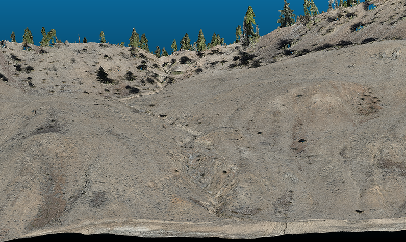
Transform complex landscapes into decision-ready terrain intelligence. Using UAV LiDAR, photogrammetry, and advanced terrain modelling, we identify the conditions that matter most. Supporting exploration planning, infrastructure design, environmental assessment, and risk management before significant resources are committed.
Applications:
-
Exploration target prioritization
-
Access and corridor planning
-
Slope stability assessment
-
Watershed and drainage analysis
-
Environmental baseline planning

Monitor Change with Confidence
Description
Measure how landscapes evolve over time using consistent, repeatable workflows. From construction progress and mine reclamation to environmental monitoring and vegetation recovery, repeat surveys provide objective evidence to support informed decisions throughout a project's lifecycle.
Applications:
-
Reclamation monitoring
-
Site change detection
-
Vegetation recovery assessment
-
Construction progress tracking
-
Environmental monitoring programs
-
Long-term project reporting
Environmental Intelligence
Description
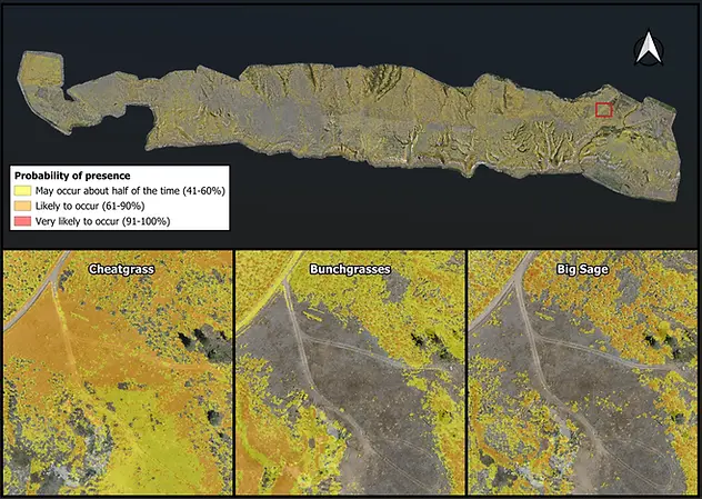
Reveal ecological patterns that traditional imagery cannot detect. By combining multispectral analysis with terrain information, we help organizations evaluate vegetation health, habitat conditions, invasive species, reclamation progress, and environmental change with greater confidence.
Applications:
-
Invasive species probability and cover class distribution mapping
-
Vegetation classification
-
Habitat assessment
-
Reclamation monitoring
-
Environmental compliance
-
Ecological baseline surveys

Access Critical Terrain
Description
Safely collect high-quality geospatial data in remote, steep, or environmentally sensitive terrain where traditional survey methods are difficult, costly, or unsafe. UAV-based workflows provide rapid access to critical information while reducing field exposure and improving operational efficiency.
Applications:
-
Remote site assessment
-
Mountainous terrain mapping
-
Forestry projects
-
Mining and exploration support
-
Environmental field programs
-
Infrastructure corridor surveys
Capabilities
Specialized geospatial solutions for complex terrain and environmental challenges.
Aurora Terrain Intelligence combines terrain mapping, ecological analysis, spatial modeling, and advanced monitoring workflows to transform complex landscapes into actionable information for environmental, infrastructure, and resource development projects.
LiDAR Terrain Mapping
Reliable and repeatable terrain acquisition, elevation modeling, and surface characterization for engineering, environmental,
and infrastructure applications.
Repeat Monitoring
Consistent acquisition workflows for long-term environmental monitoring, reclamation assessment, and site change detection.
Survey Workflows
Standardized data acquisition methods supporting temporal analysis, environmental monitoring, and project consistency.
Multispectral Analysis
Vegetation classification, ecological assessment, invasive species detection, and environmental monitoring support.
Spatial Classification Modeling
Advanced spatial modeling workflows integrating terrain, vegetation, and environmental datasets to support ecological assessment and decision-making.
Remote Terrain Operations
Safe and efficient data acquisition in steep, remote, and environmentally sensitive terrain throughout Western Canada.
About Aurora Terrain Intelligence
The value isn't collecting more data. It's reducing uncertainty so better decisions can be made.
Aurora Terrain Intelligence helps organizations understand complex landscapes through advanced terrain mapping, ecological analysis, and geospatial data collection.
We combine UAV operations, LiDAR mapping, photogrammetry, spatial modeling, and environmental monitoring workflows to transform terrain data into practical project intelligence.
From infrastructure planning and corridor assessments to ecological monitoring and reclamation programs, our focus is on delivering reliable, repeatable information that supports informed decision-making.
Operating throughout Western Canada, Aurora Terrain Intelligence specializes in challenging terrain, remote environments, and projects where accurate spatial information is critical.
Why Aurora Terrain Intelligence?
✓ Specialized expertise in remote and difficult terrain
✓ LiDAR, photogrammetry, multispectral, and thermal imaging workflows
✓ Advanced spatial modeling, probability surfaces, and ecological classification
✓ Repeatable monitoring, temporal analysis, and change detection
✓ Practical solutions aligned with project objectives
✓ Extensive experience operating in remote and environmentally challenging landscapes
Request Consultation
Service Area
-
British Columbia
-
Alberta
-
Saskatchewan
-
Western Canada
Contact Information
Grant Carlson
Founder & Principal Consultant
Aurora Terrain Intelligence
250-571-6542


Aurora Terrain Intelligence
A Division of Aurora UAV Services